70 more km around Umm al-Fahm

Today we collected 70 more kilometers of magnetic data on the bike to cover the southern part of the study area, near Umm al-fahm. In general, this region consists of sedimentary rocks, but here and there some volcanic units are exposed: the Cretaceous volcanics are equivalent to those of Mt. Carmel.

In the map below, available lines are in green. The new lines are in purple.

Find a volcano…while riding your bike

Ground magnetic measurements combine scientific work with a fun outdoor experience. After some corrections, the data is combined into regional magnetic maps. With further calculations It is used for modeling the subsurface structure and, for example, to reconstruct the 3D shape of buried volcanoes. In the past 20 years, we walked along ~900 km in northern Israel, to collect data.

In April 2016, we developed a new technique for data collection, using a bicycle. We fixed a triangular frame of piles to the bike. The magnetic sensor was placed 2.2 m above the ground and 1.65 m in front of the bike. The GPS antenna was located 2 m above ground. Both sensors were wired to the magnetic receiver placed on the chest of the rider to facilitate real-time QC of the measurements. It sounds a bit cumbersome, and it really is. But this arrangement works great. By new we have collected over 1000 km on the bike through numerous towns and villages, and across the fields between them.

9c4c3d2b-79c7-4f38-9bac-dca7c8379a3e.jpg

Winter measurements (you can tell by the coat). Uri is riding from the eastern Galilee down the hill towards the Sea of Galilee. The ropes and tubes stabilize the sensors, and at enable flexibility.

Coverage of measurement transects until March 2017

The measurements on the peculiar-looking bike evoke a lot of curiosity from everyone. Children ask if this is a spaceship or a sophisticated camera. Adults ask what am I measuring, and what is the research. Car and truck drivers slow down to look and even stop to ask. In short – nobody remained indifferent strange-looking bike…and we are more than happy to provide on-the-spot simple explanations about magnetics and geology.

IMG-20160421-WA0001.jpg

At the end of each section, the bike is mounted on the vehicle and transferred to the next transect. 

Cover page and Discovery !

July first was a great day for the Bike-Mag project. AGU’s EOS magazine decided present our project on the cover page !!!

Following the online publication, a crew of Discovery Canada came to film the Bike-Mag in action. The experience was amazing. That they came from Canada, on Canada Day to film a project running Canadian equipment!

EOS_Bike_Mag_Coverpage

Link to the full article

Too hot for riding?

QG

Yes. It was too hot, and it wasn’t even summer. I parked my miniature car in Kibbutz Afek and pulled the “inflatable” Bike-Mag out. The bike is about twice as high as the car. This time the task was to measure across the Qishon graben (See figure from Schattner et al., 2006). This is a remnant of an old rift that crossed the southern Galilee in a northwest trend.

The morning temperatures were nice, around 29 degrees centigrade. Close to midday, it was too hot to ride. The problem was that I only got to the middle of the ride. In this case, every rider knows the drill – switch to auto. Don’t feel, just ride. Most of the ride as flat, besides some hills. These 40 kms were a bit exhausting. Here are some pictures:

This slideshow requires JavaScript.


Fixing the frame

I built the frame of pipes in April 2016, and somehow it held for one year. With only a few repairs I rode it over 1500 km until it broke in Tabor Creek. It was frustrating since I don’t have any financial support for the project. The solution came through a friend of a friend that happens to work at https://www.metzer-group.com . Pipes are their business, and they are truly experts. With a lot of patience, they took me around their place to find the right pipes. We found some of the leftovers that fit like a glove to the frame. These leftover pipes cover the weak connections between the pipes we had. Metzerplast people worked their lathe with endless patience to fix the aluminum pipe and the screws that broke. That was incredible, and all for free.

80km offroad…untile the frame broke

During winter we mapped the eastern Galilee, mostly on paved roads. The dirt tracks were too muddy. That’s ok for regular riding. But with the frame of pipes, it is impossible to ride more than a meter with mud because of the balance. Now the spring is almost over, and that means four things: all the dirt roads are completely dry, the thorns are still not too spiky, the snakes are still hiding (I hope), and the temperatures are still below 35 centigrade. We headed to fill the holes in the mapping over Yavne’el Valley and the drainage of Tabor Creek. The terrain was not easy, especially since the middle pipe limits the handlebar from turning to the right. Next time you ride off-road try not to turn right for 80 km.
We spent two days there. Just before the last descend to Tabor Creek the front pole broke. We expected this to happen at some stage. All in all, the frame held very nicely since April 2016 along about 1500 km of riding. The frame held the sensor, and no harm was done. But we had a big problem.
Please follow this link to join the ride:
https://www.youtube.com/watch?v=ipoZNuiwX7A

70 km of data on May 4, 2017

Today I went alone for a 70 km bike ride to collect magnetic data. The weather was perfect. I rode along the coastal plain of Mt. Carmel, first north and then south. In a regular ground survey, it would have taken 7 days, 2 technicians, 1 car and 6*2 nights at a hotel + 7*2 per Diem. For me, it was about 16 USD, which includes gas for the car and some food. So the new design can save some expenses. In addition, I met with a group of kids on a field trip. They were excited to hear about the buried volcanoes and asked if they need to worry. Well, the last eruption nearby was a few million years back. But I took the opportunity to tell them a bit about the difference between earthquakes and tremors, and the way to detect them. Science lesson for free. And the key to their heart is the initial spontaneous curiosity.

Here is an updated map:

And some pictures from this great day:

Bike-Mag on EOS

Hurray!!!!

My first article about Bike-Mag was published !!. I’m so happy. Early signs of the positive support of the scientific community came through hundreds of reactions (more than a thousand) that came by facebook and twitter as well as email. I hope that researchers will see the new method as an alternative to walking.


Please read the Article here:

https://eos.org/project-updates/a-bike-built-for-magnetic-mapping

EOS

Big anomaly, low topography

Spring is the best time to map the hills of Menashe. Sometimes it seems like Tuscany. The surface geology is quite confusing. It is built of chalk, and sometimes it is quite difficult to identify a geological fault when all you have as a clue is two shades of white on both sides. The subterranean landscape is less monotonous. Previous studies have shown that magmatic rocks underlay this region. Based on some outcrops we know the age of volcanism – sometime during the mid-Miocene. But the magnetic anomalies may source from older rocks. So we went out to measure. The timing was great – during Passover vacation when everyone is hiking, cycling and driving there.

This slideshow requires JavaScript.

We collected data along about 35 km, not so far from the famous archeological site of Armageddon. The new lines are marked in purple. Available lines in green:

Curiosity

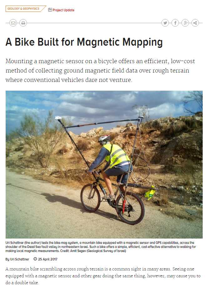
One of the best experiences in this project is to see again and again the spark of curiosity in the eyes of the bystanders. This genuine and clean thought comes in a flash, saying “what on earth are these strange bike…and weird biker doing”. We see these looks everywhere along the hundreds of communities we passed. And the best part is that the curiosity crosses all ages, genders, origins, status….in short – everyone. When they ask, we stop the data collection and explain about the geology, volcanoes, and how to search for them in the subsurface. It is very rewarding to see what a short jump from a regular day to the geological space can do to people. Here are some pictures:

DSC_1994_sm_blur.jpg

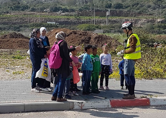
While crossing the Harod basin (half graben bounded by the Gilboa fault). I met this great group of kids. Their guide explained about the history of the place when suddenly I arrived. So the teacher asked the kids to clear the road so I will not fall. Instead, I stopped and asked the kids if they can guess what am I doing with the bike. The results were even stranger than I anticipated. Finally, I asked the teacher to take our picture.

DSC_1323.jpg

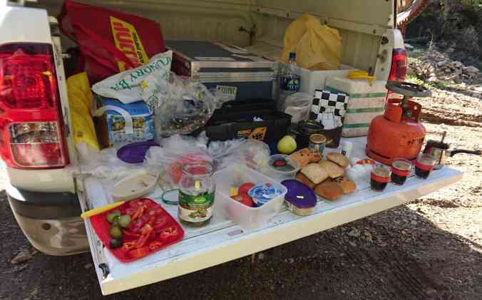
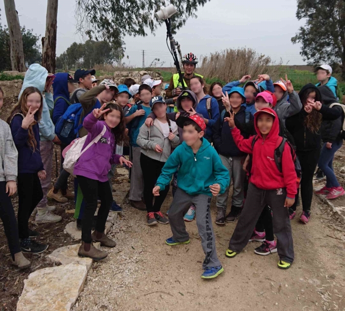
The best meals are in the field, especially after a long ride. But as we finished preparing all the goodies we heard kids walking on the other side of the road, near Fureidis

20170223_104420_cr.jpg

…So I took the sensor and went to talk with them. I asked the teachers if I can explain what we are doing and they gladly said they will translate. I don’t speak Arabic, but I do know how to get the message across – science is great! These first graders had some great questions, and also some interesting suggestions for the bike. DSC_1316.JPG

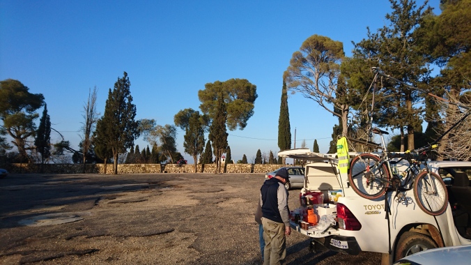
On the top of Mt. Tavor stopped to eat just before riding down the serpentine white-knuckling slope. A single, narrow road connects the village at the foothill with the top. Taxis drive back and forth to bring tourists. The taxis fill the small parking and in a minute vanish, like a fast motion video of clouds moving over the earth while we stand and drink our coffee. And then one of the taxi drivers stayed and looked for a way to start a conversation. He asked about the bike and we explained and talked about geology. This took him several decades back, to his late father who was a geography teacher. Wonderful stories. 3_cr.JPG

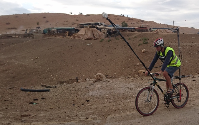
We heard similar flashbacks from shepherds (above) and from a tow truck drive (below), driven by their curiosity.

3b9152bf-8dfc-4749-869c-178c3dd03142.jpg